We didn’t hike the trail. To walk on that snow, we would need snow shoes. We weren’t dressed for the occasion. The snow on this trail was up to my hips and I am not short, so we took photos on the side of the road.
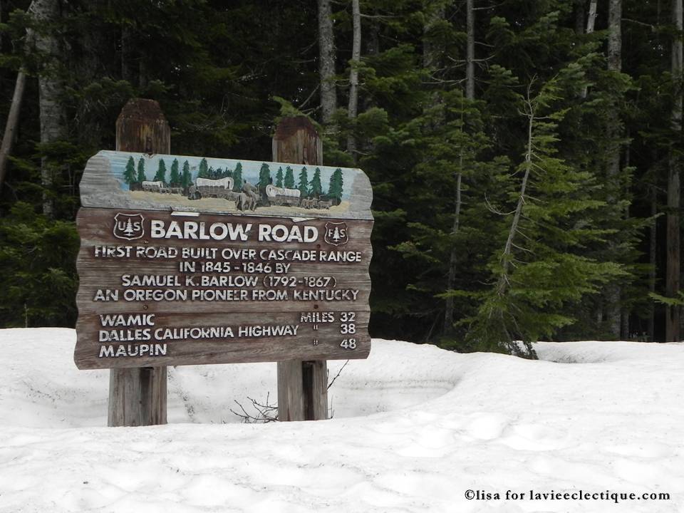
The sign says:
Barlow Road is the first road built over Cascade Range in 1845 – 1846 by Samuel K. Barlow (1792-1867). Mr. Barlow was an Oregon Pioneer from Kentucky.
According to a lot of the account, the descent is the hardest part about this trail as it’s really steep.


Really cool (and probably colder than I can handle). But I have some friends who’ve just moved to Oregon, this spring. I should tell them about this. Thanks
Sure. Why not. 🙂 I am not sure if it’s snowing there now though. Maybe starting…we were there earlier this year, so Spring time there’s a lot of snow for sure.
Wow, lots snow there… Beautiful trail!
Yeah, it was a lot of snow when we visited. I am not sure right now though. Maybe starting to snow again…